
PILGRIMAGE TO CUSTER
by Jackie Jura, 2023
(my commentary in blue)
(you can listen using text-to-speech on your device)
1.JOURNEY TO CUSTER'S LITTLE BIG HORN
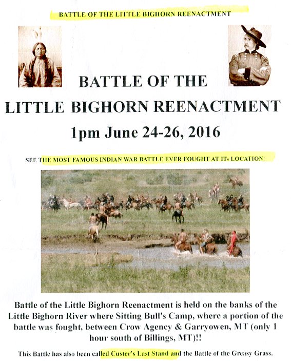
In June 2016 I travelled to Montana from Alberta to attend the re-enactment of Custer's Last Stand -- the Battle of the Little Big Horn -- on the 140th anniversary of it happening on June 25th, 1876. June 25th also happens to be the day George Orwell was born 27 years later in 1903.
During this journey I'd be crossing on bridges over some of North America's most important rivers -- including the North Saskatchewan in the city to which we'd just re-located from over the Rockies in British Columbia. If you look closely at the boat up the river from the bridge I'm standing on you'll see it's a vintage paddle-wheeler like the ones travelled on in Custer's day. Behind me are the beautiful glass pyramidal greenhouses of the botanical gardens by the bridge. I purchased the Trilby hat I'm wearing in the gift shop of the conservatory..


As I write this now, it's February 2023 and alot of water has passed under those bridges and I've been swimming against the current. Having now washed up on shore I'm ready to share that Custer journey with readers.

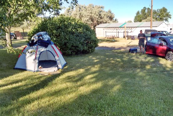
My husband Bob would be coming along for the ride to handle the reins of our speedy steed and act as quartermaster. We'd be pitching tent along the way on riverbanks under cottonwoods -- like Custer and the 7th Cavalry.
This trip was spur of the moment (pardon the pun) because we had only recently moved to Edmonton, Alberta and weren't even all unpacked when the significance of the upcoming date -- June 25th -- came to mind -- Orwell's birthday and Custer's death. I'd been a Custer buff -- a Custeriana -- for many years having discovered the life and times of George Armstrong Custer during my study of Lincoln and the Civil War and the Indian Wars.


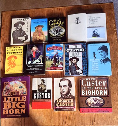
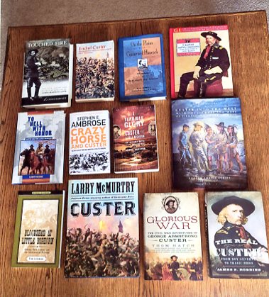
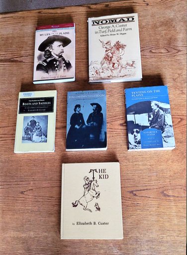
I've read dozens of books just on Custer alone and through discernment of that information came to love him -- not hate him as his enemies do. Nothing is more rewarding emotionally, spiritually and psychologically than searching for truth and finding it. One of the most amazing facts about Custer is that not only is he one of the most written about people in the history of America, he himself is also a writer of American history while it was happening and he was making it. He and his beloved wife Libbie have authored several books. Above is a display of my Custer books pulled from the shelves below the Lincoln shelf. They're placed in chronological order of publication from 1874 to 2014. I'll also sometimes be referencing books from my Indian Wars bookshelves scanned above.

Custer did his writing -- reports, letters and articles for magazines -- with an ink-dip pen by candelight, in his headquarters tent after a march or battle, while his exhausted men, in their tents around him, were snoring. Here's what one publisher of MY LIFE ON THE PLAINS said about Custer: "He wrote at times under conditions of hardship unexampled perhaps in the annals of literature -- at night in his tent by a feeble light while all his companions were sleeping. At least one contribution to GALAXY magazine was thus composed after a 50-mile march through the badlands of the Yellowstone, from notes which he had taken along on the march". Anyone who's ever written an essay or an article at their leisure, in a comfortable chair at their desk, with time to edit and make changes -- let alone under pressure of a deadline -- can comprehend the gargangtuan task Custer accomplished putting pen to paper for posterity -- writing Orwellianly clear as a window pane.
In chronicling the journey to Little Big Horn and the significance of the Custer places we stopped at along the way, I'll scan passages from books that people can click on to enlarge for reading in fuller context. The books I chose are written from the horse's mouth and by people who lived and worked with and studied Custer and with whom I share their opinions and conclusions. I'll be using maps and diagrams to help readers visualize time and place because that's how I like to learn -- I need to see the big picture, the lay of the land, before I can understand.

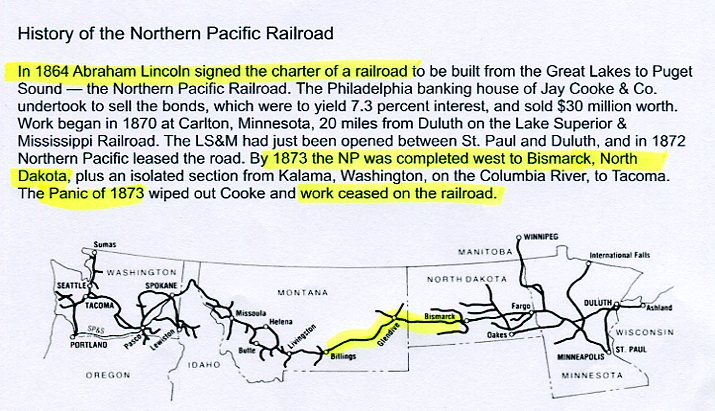
The map above is an overview of the places where Custer -- and thousands of other USA soldiers -- fought Northern Plains Indians -- mainly Sioux and Cheyenne -- during the 1860s and 1870s. Custer fought in the Yellowstone Expedition in 1873 and in 1876 at the Battle of the Little Big Horn.
Our first stop in Montana, where we stayed the night, was Great Falls on the mighty Missouri. This is where Lewis & Clark, during their Voyage of Discovery in 1804 to 1806, had to leave the river and portage overland because of insurmountable falls.


I have a beautiful, padded-cover, National Geographic LEWIS & CLARK coffee-table book by Stephen Ambrose, that I was thinking about and trying to remember details.


In the morning I stood in front of the statue of Merriwether Lewis, William Clark, their servant York and the dog, Seaman, overlooking the Great Falls in the distance.

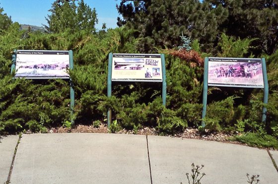
We spent a couple hours at the Lewis & Clark Interpretive Center with displays of hundreds of life-size artifacts of the entire voyage including how they portaged the falls. A caption read: "Despite their splendor, the Great Falls presented danger and hardship for the explorers. All equipment and supplies, including canoes, had to be carried by hand or in makeshift wagons overland for approximately 18 miles to bypass the 21-mile stretch of the 5 falls".
Then we were on the road south to the Yellowstone River and I couldn't believe it when we came upon windmills for as far as the eye could see -- some spinning, most not.
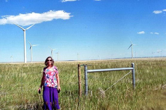

It seems Montana, with enough coal under that ground to fuel past, present and forever the electricity needs of several surrounding states, has fallen victim to the cartoonish, farcical CO2 hoax, ie "Fossil fuels (coal, oil, natural gas, humans) are dangerous pollutants because they emit carbon dioxide (the air we exhale) into the atmosphere which causes global-warming -- like in a greenhouse -- and we're all gonna drown, starve or be burned to a crisp". I've written extensively about this over the years. See DEFENDING CO2-OIL-GAS-COAL & CO2 SCAM PICS SAY THOUSAND WORDS
On July 4, 1803 President Thomas Jefferson said to Lewis & Clark, "The object of your mission is to find an all-water route across the continent to the Pacific Ocean". He also ordered them "to record mineral resources of every kind; but more particularly metals, limestone, pit coal, & saltpeter". At that time, Jefferson considered coal the basic natural resource of the future. Travelling down the Yellowstone River Clark noticed its black seams and wrote in his journal "Below this river on the Stard Side [right side] at a few Miles from the Rochejhone [yellow rock] the hills are high and ruged Containing Coal in great quantities. ~ William Clark, July 29, 1806"
Within a few hours of leaving Great Falls we came to Billings and crossed the bridge over the Yellowstone, "the longest free-flowing river in America and the longest river without dams on it".
We turned east, following the highway along the river about twenty-miles until we came to Pompey's Pillar which is a must-see (can't miss it) Custer place to visit.
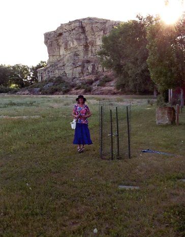
In 1806, after Lewis & Clark reached the Pacific and were on their way back, retracing their route through the Continental Divide, they split into two expeditions. Lewis went north of the Missouri to explore the Marias river and Clark went south to explore the Yellowstone. Coming down from the Rockies -- with huge help from Sacagawea who had found the trail and the pass -- Clark's expedition entered the Yellowstone about 60 miles west of Billings. Then travelling downstream, on their right, a towering yellow sandstone rock jutted up from nowhere and they pulled over the canoes to explore. After Clark had climbed it he signed his name on the rock and gave it the name "Pompey's Pillar" after Sacagawea's 2-year-old son, Pomp.


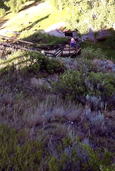
I followed Clark's footsteps to the top of the rock (blessedly using stairs) and got a panoramic view of the plain and Big Horn mountains in the distance and the Yellowstone flowing west to east below.


The storyboard beside me reads: "The Yellowstone Valley at Pompeys Pillar was a crossroads for travelers and wildlife and a cavalry campsite and staging area. The artist's rendering on this sign depicts the area directly across the river as it may have looked in 1873 when Lt. Col. George Armstrong Custer and men of the Yellowstone Expedition, commanded by Col. David Stanley, camped there. The troops protected engineers and surveyors working on the Northern Pacific Line from Indian attacks. The completed railroad would soon link the rest of the country with the North Pacific coast."
67 years after Clark saw Pompey's Pillar while paddling down the Yellowstone, Custer saw it from horseback pathfinding for the railroad up the north bank. Along the way Custer's 7th Cavalry was involved in two big battles with Indians -- both times sending the hostiles skedaddling.
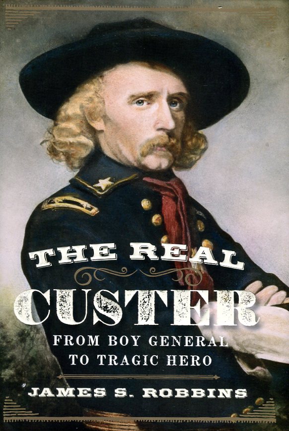
Below are pages scanned from the book THE REAL CUSTER: FROM BOY GENERAL TO TRAGIC HERO, by James S Robbins, published in 2014. In [square brackets] I've added comments.
Battle on the Yellowstone
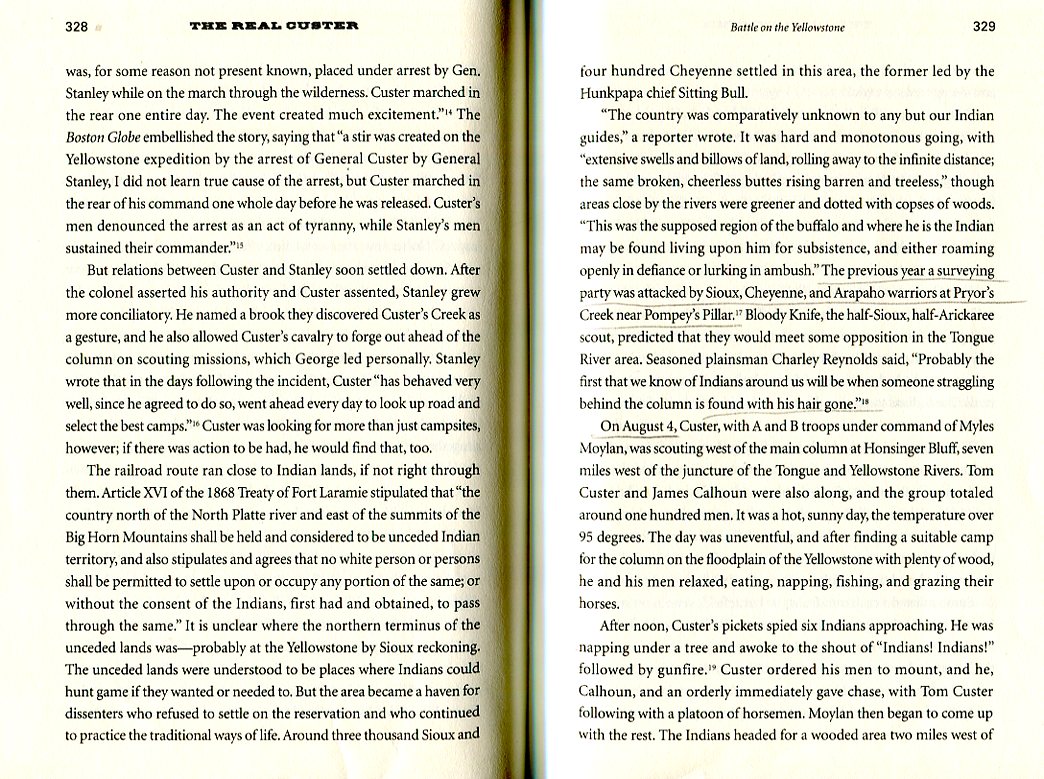
"...The railroad relied on Army escorts for its workers, and in the summer of 1873, ten companies of the 7th Cavalry under Custer joined a larger force of infantry to guard engineers and surveyors venturing deep into traditional Indian lands along the Yellowstone. The expedition set off on June 20, 1873, with 79 officers, 1,451 men, 353 civilians, and 7 scouts... Colonel David S Stanley of the 22nd Infantry regiment led the Yellowstone expedition. Stanley was an 1852 West Point graduate [Custer in 1861] and, like Custer, a wartime major general... Relations between Custer and Stanley soon settled down. After the colonel asserted his authority and Custer assented, Stanley grew more conciliatory. He named a brook they discovered Custer's Creek as a gesture, and he also allowed Custer's cavalry to forge out ahead of the column on scouting missions, which George led personally... Custer was looking for more than just campsites, however; if there was action to be had, he would find that too. The railroad route ran close to Indian lands, if not right through them... The area became a haven for dissenters who refused to settle on the reservation and who continued to practice the traditional ways of life. Around three thousand Sioux and four hundred Cheyenne settled in this area, the former led by the Hunkpapa chief Sitting Bull. "The country was comparatively unkown to any but our Indian guides", a reporter wrote...
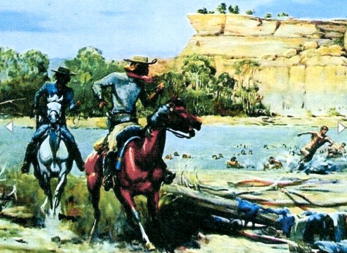
"...The previous year [1872] a surveying party [which quit because of Indian attacks] was attacked by Sioux, Cheyenne, and Arapaho warriors at Pryor's Creek near Pompey's Pillar [while bathing naked in the river as shown in image]. Bloody Knife, the half-Sioux, half-Arickaree scout [whose brains splattered Reno's face at LBH 3 years later], predicted that they would meet some opposition in the Tongue River area. Seasoned plainsman Charley Reynolds said, "Probably the first that we know of Indians around us will be when someone straggling behind the column is found with his hair gone" [which happened to the veterinarian & the sutler during Custer's expedition].
"...On August 4, Custer, with A and B troops under command of Myles Moylan, was scouting west of the main column at Honsinger Bluff, seven miles west of the juncture of the Tongue and Yellowstone Rivers. Tom Custer and James Calhoun were also along, and the group totaled around one hundred men. It was a hot, sunny day, the temperature over 95 degrees. The day was uneventful, and after finding a suitable camp for the column on the floodplain of the Yellowstone with plenty of wood, Custer and his men relaxed, eating, napping, fishing, and grazing their horses. After noon, Custer's pickets spied six Indians approaching. Custer was napping under a tree and awoke to the shout of "Indians! Indians!" followed by gunfire. Custer ordered his men to mount, and he, Calhoun, and an orderly immediately gave chase, with Tom Custer following with a platoon of horsemen. Moylan then began to come up with the rest. The Indians headed for a wooded area two miles west of where Custer had camped. But they were not fleeing very vigorously, and George sensed a trick. Custer stopped the pursuit, and the fleeing Indians paused. Then over 250 mounted warriors broke from the woods, charging toward the cavalrymen. Indian scouts had spotted Custer's men earlier in the morning, and Hunkpapa Sioux from Sitting Bull's encampment of four hundred to five hundred lodges, west near Locke Bluff, had gathered in the woods for battle...
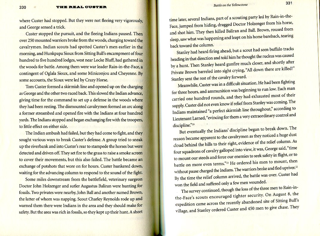
"...Tom Custer formed a skirmish line and opened up on the charging as George and the other two raced back. This slowed the Indian advance, giving time for the command to set up a defense in the woods where they had been resting. The dismounted cavalrymen formed an arc along a former streambed and opened fire with the Indians at four hundred yards. The Indians stopped and began exchanging fire with the troopers, to little effect on either side. The Indian ambush had failed, but they had come to fight, and they sought various ways to break Custer's defense... The battle became an exchange of potshots that wore on for hours. Custer hunkered down, waiting for the advancing column to respond to the sound of the fight... Stanley had heard the firing... Stanley sent the rest of the cavalry forward.
"...Meanwhile, Custer was in a difficult situation. He had been fighting for three hours, and ammunition was beginning to run low. Each man carried one hundred rounds, and they had exhausted most of their supply. Custer did not even know if relief from Stanley was coming. The Indians maintained "a perfect skirmish line throughout evincing for them a very extraordinary control and discipline". But eventually the Indian's discipline began to break down. The reason became apparent to the cavalrymen as they noticed a huge dust cloud behind the hills to their right, evidence of the relief column. As four squadrons of cavalry galloped into view, it was, George said, "time to mount our steeds and force our enemies to seek safety in flight, or to battle on more even terms". He ordered his men to mount, then without pause charged the Indians. The warriors broke and fled upriver. By the time the relief column arrived, the battle was over. Custer had won the field and suffered only a few men wounded.
"...The survey continued... On August 8, the expedition came across the recently abandoned site of Sitting Bull's village, and Stanley ordered Custer and 450 men to give chase. They tracked the Indians swiftly up the north bank of the river, and two days later reached a point three miles below the mouth of the Bighorn where the Indians had crossed. Custer attempted to make the south bank but the Yellowtone was too deep and swift.

"...The next day, "the river had fallen considerably and preparations were being made to cross over when a number of shots were fired from the woods on the opposite bank, and soon after the Indians appeared in force". At first light, friendly Indian scouts came "tumbling down the bluffs head over heels, screeching, 'Heap Indian come'". Hundreds of warriors appeared along the bluffs above the south bank of the river, firing at the cavalrymen, who returned fire with enthusiasm... This back and forth went on for some time, and while Custer's men were occupied, three hundred Indians crossed the river above and below their position, a tactic Sitting Bull had used against the surveying party the previous year. The Indians rushed to the high bluffs six hundred yards to Custer's rear and began to open fire. The 7th was caught in a crossfire. Custer had a horse shot out from under him -- the eleventh of his career -- and his orderly [Custer's devoted striker who protected him for Libbie], Private John Tuttle of Company E, who had been boldly standing in the open showing off his considerable skill as a shooter, was killed. But Custer had been in tougher scrapes than this. He pushed a picket line toward the Indians to his rear, then ordered a charge. "George sat on his horse out in advance, calmly looking the Indians over", Thomas Rosser [survey engineer & Custer friend at West Point and enemy during Civil War] wrote of the scene, "full of suppressed excitement, but also with calculating judgment and strength of purpose in his face. I thought of Custer then as one of the finest specimens of a soldier I had ever seen". The sudden charge broke the Indian position, and the cavalry pursued them for three miles. Meanwhile, the main column had come up. Stanley ordered artillery fire placed on the ridgeline where the Indians had congregated across the river, "producing a wonderful scampering out of sight", he wrote.
"...In the engagements on the Yellowstone, the Indians were armed with new, advanced weapons, and had adapted to them with fresh tactics. But Custer's takeaway was that disciplined and well-organized cavalrymen employing coordinated firepower could hold their own against, and even defeat, superior numbers of Indians....
"...Reaching Pompey's Pillar soon after the August 11 battle, the column went north to the Musselshell River, down the valley to the Big Bend, then divided. The 7th Cavalry headed back to Fort Lincoln directly, and Stanley with the rest of the expedition went south, going via the Yellowstone.... The Yellowstone expedition lasted 95 days, made 77 encampments, and covered 935 miles. It surveyed previously unmapped areas and found a number of possible railroad routes. The 7th Cavalry engaged the Indians, and Custer won his battles... But on September 18, 1873, a week before the expedition ended, the Cook and Company investment bank, which had underwritten the Northern Pacific, went bankrupt... His downfall led to other banks, railroads, and businesses going bust, precipitating the Panic of 1873 [until Custer found gold in 1874 in the Black Hills expedition]. The economic hard times lasted in the United States for six years, and the main line of the Northern Pacific was not completed until 1883..."
~ end quoting from Battle on Yellowstone by Robbins ~

Not long after leaving Pompey's Pillar we came to the mouth of the Big Horn at a village named Custer [an army fort built in 1877]. After a quick tour of the town we turned south and followed the river to Hardin where it meets the Little Big Horn river. We'd be staying there for two nights to watch the re-enactment of the battle on Saturday and walk the battlefield on Sunday.
The town was packed with travellers from across the country and around the world descending on Hardin for the 3-day Battle of Little Big Horn festivities. We managed to find a patch of grass to pitch our tent on a make-shift campground behind some businesses. That evening we walked around town and chatted with locals who told us rollicking stories and what else to see and do in Big Horn County.
...cont'd at 2.CUSTER ALT-HISTORY BIG HORN VICTORY
1.JOURNEY TO CUSTER'S LITTLE BIG HORN
2.CUSTER ALT-HISTORY BIG HORN VICTORY
3.LAST WORD ON CUSTER FROM FRONT
4.CUSTER MASSACRE AT GATES OF HELL
5.HOMAGE TO CUSTER AT LAST STAND
6.CUSTER ON BOZEMAN & DEADWOOD
7.CUSTER GOLD BLACK HILLS & RUSHMORE
8.STATUES OF PRESIDENTS & CUSTER
9.CUSTER'S GETTYSBURG ON THE PLAINS
10.CUSTER & SITTING BULL NOT EQUALS
11.CUSTER AT HOME AT FORT LINCOLN
Jackie Jura
~ an independent researcher monitoring local, national and international events ~
email: orwelltoday@gmail.com
HOME PAGE
website: www.orwelltoday.com